Dayara Bugyal
A scenic Himalayan meadow trek through forests, rhododendrons and open grasslands with panoramic mountain views.
Quick Info
Altitude
3639 m
Difficulty
Easy
Distance
~20 Km
Base Village
Raithal / Natin
Duration
2-4 Days
Best Season
April – June
Highlights
- Vast alpine meadows
- Rhododendron and oak forests
- Barnala Tal
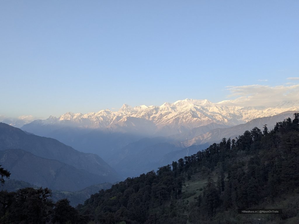
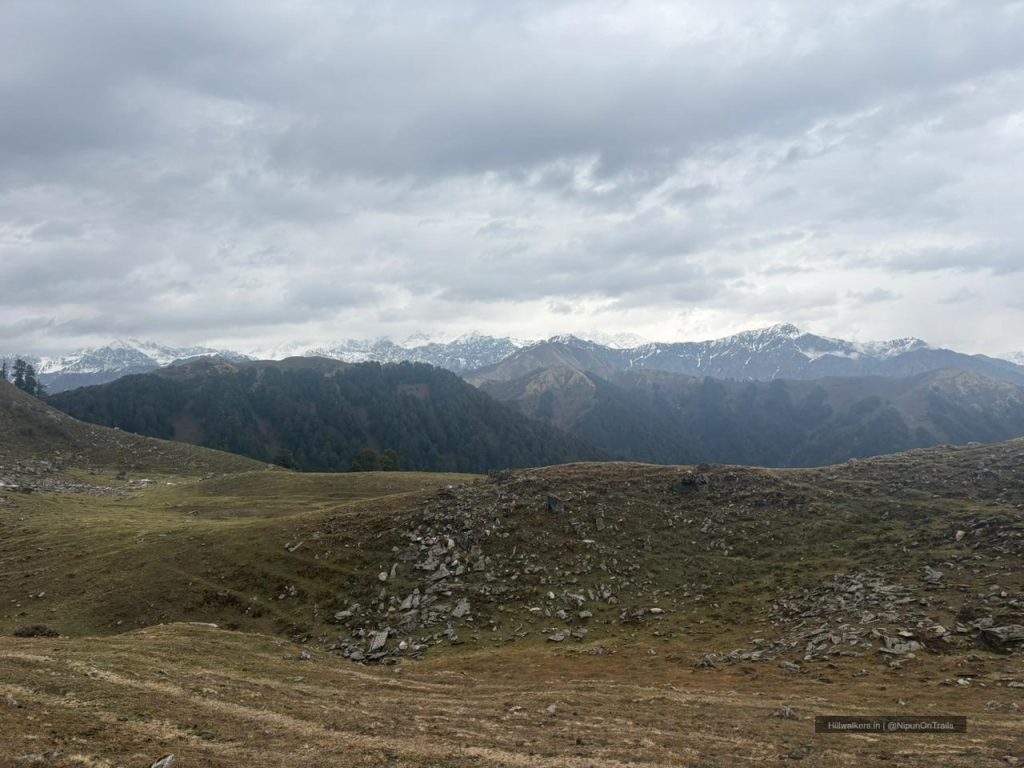
- Views of Gangotri, Bandarpoonch and surrounding peaks
- Winter snow trekking
- Suitable first Himalayan trek
Overview
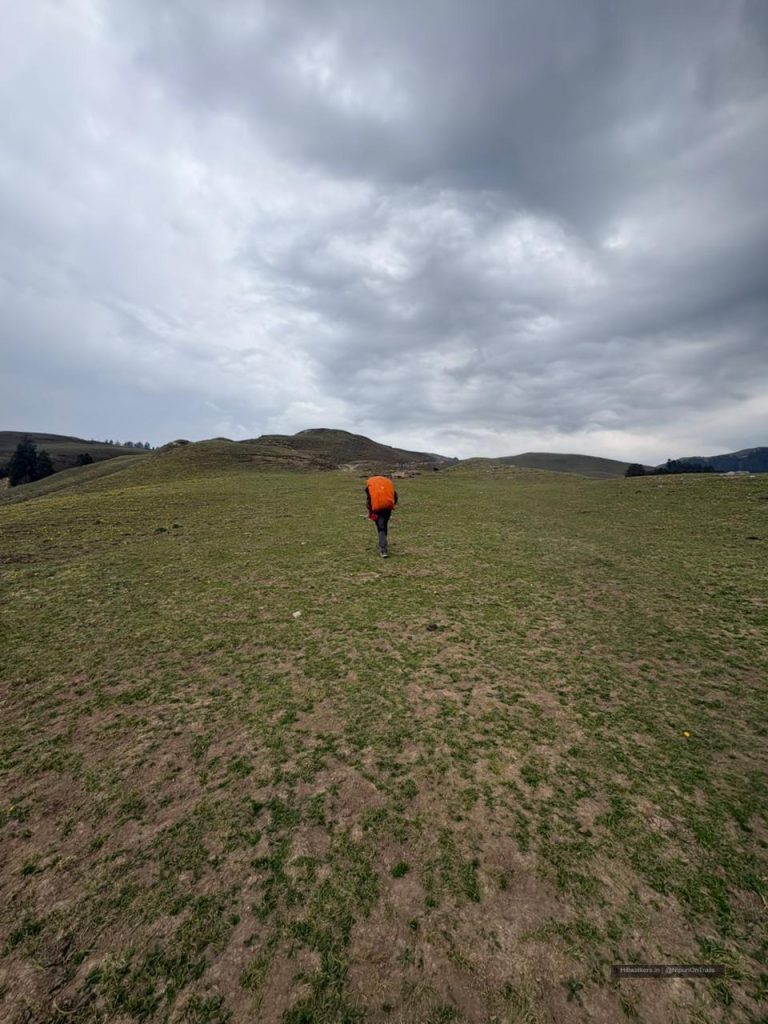
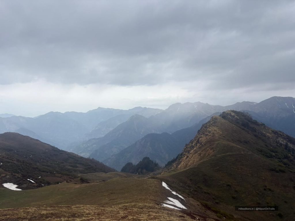
Dayara Bugyal is one of the most beautiful high-altitude meadows in Uttarakhand and a great introduction to Himalayan trekking. Unlike many mountain treks that focus on reaching a summit, Dayara is about open grasslands, changing landscapes and spending time in the mountains at a comfortable pace.
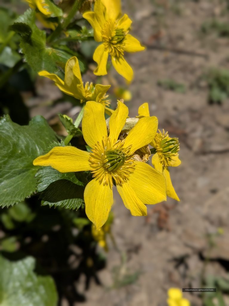
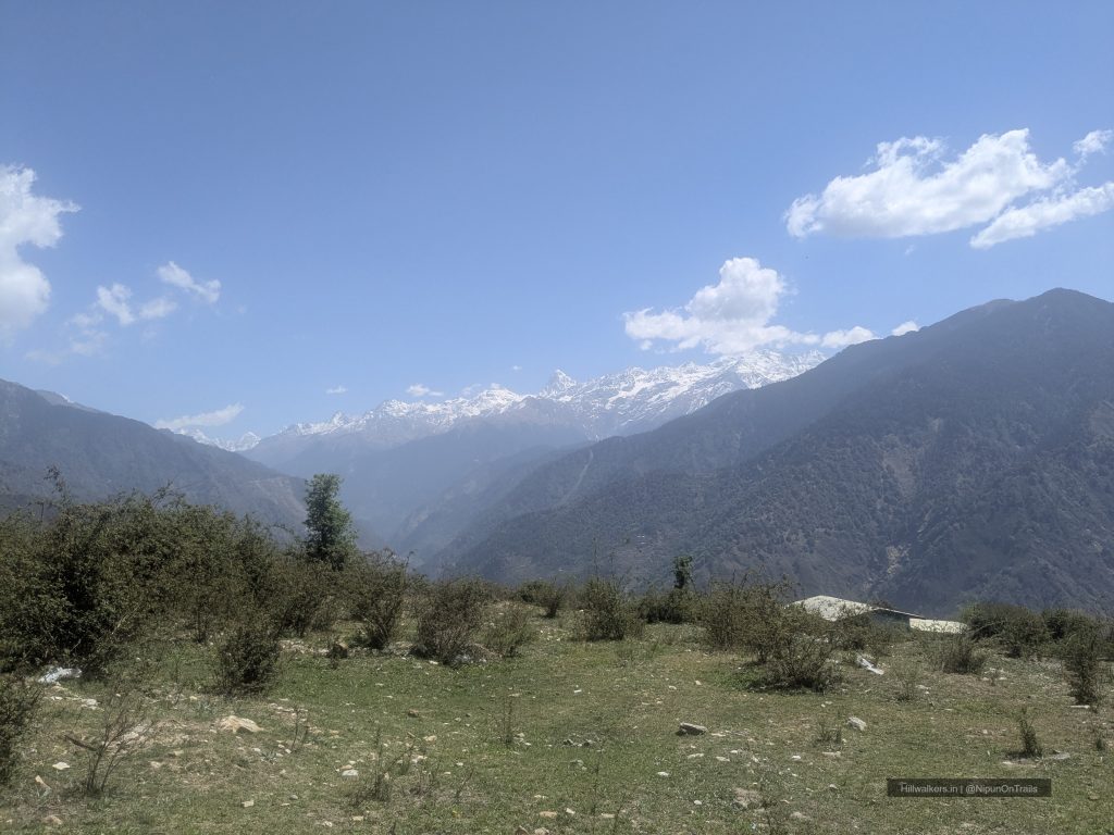
The trek usually begins from Raithal or Natin village and gradually climbs through oak and rhododendron forests before reaching the vast meadows of Dayara Bugyal. During spring, rhododendrons add colour to sections of the trail, while autumn brings crisp weather and clear mountain views. In winter, the entire meadow transforms into a snow-covered landscape and becomes a popular destination for snow trekking.
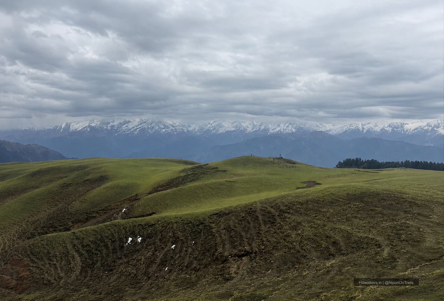
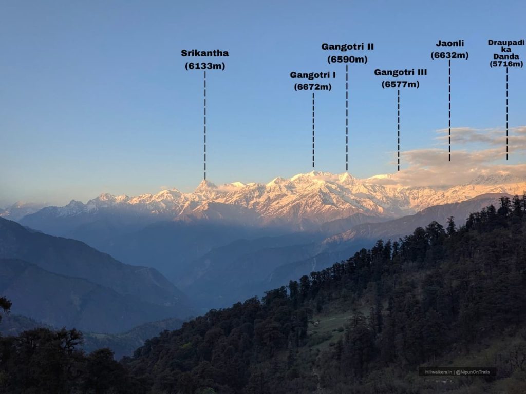
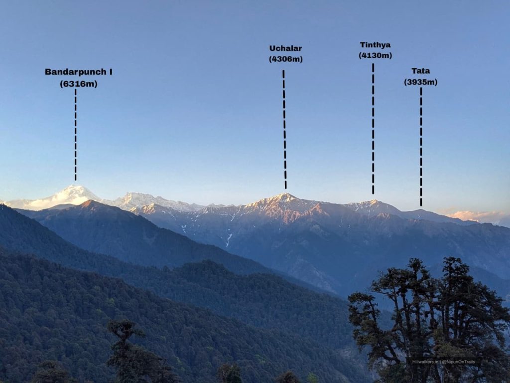
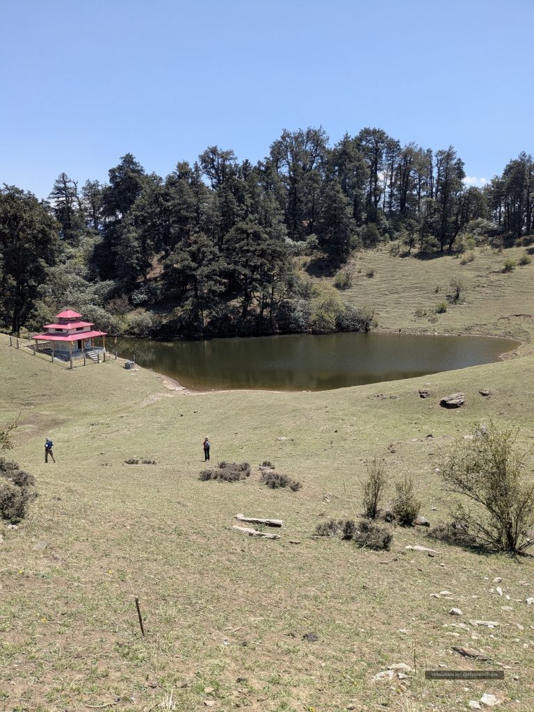
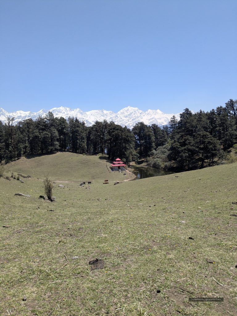
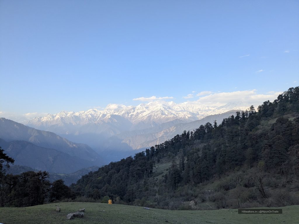
One of the highlights of the route is Barnala Tal, a small forest lake located about 20–30 minutes from Chilpada campsite. The lake is surrounded by dense forest and serves as a peaceful stop along the climb. As the trail gains height, forests slowly give way to open meadows with wide views of Bandarpoonch, Srikanth, Draupadi Ka Danda and several surrounding Himalayan peaks.
Dayara Bugyal is often recommended as a first Himalayan trek due to its moderate gradients, accessible approach and rewarding scenery throughout the journey.
Essentials
Water
Streams at Camps, Seasonal
Network
Available, at certain points
Camping
Camping Allowed
Permit
NA
Food
Villages and Carry for self Trekking
Guide
Not Mandatory
What To Carry
Quick-dry T-shirts
Trek pants
Fleece jacket
Down jacket (season dependent)
Rain jacket or poncho
Woollen cap and gloves
Extra socks
Water bottles
Electrolytes
Dry snacks and energy bars
if backpacking
Dehydrated food
Meals
Headlamp / Torche
Powerbank
Trekking Pole
Sunglass
Personal Medicines
If Backpacking,
Cooking system
Camera
Note: This checklist serves as a general guide. Adjust your gear based on weather, season, trek conditions, and personal requirements.
Routes
Raithal / Natin – Gui – Chilpada – Dayara Bugyal
Base Village: Raithal
Difficulty: Easy🟢
Duration: 2-4 Days
Distance: ~20 km
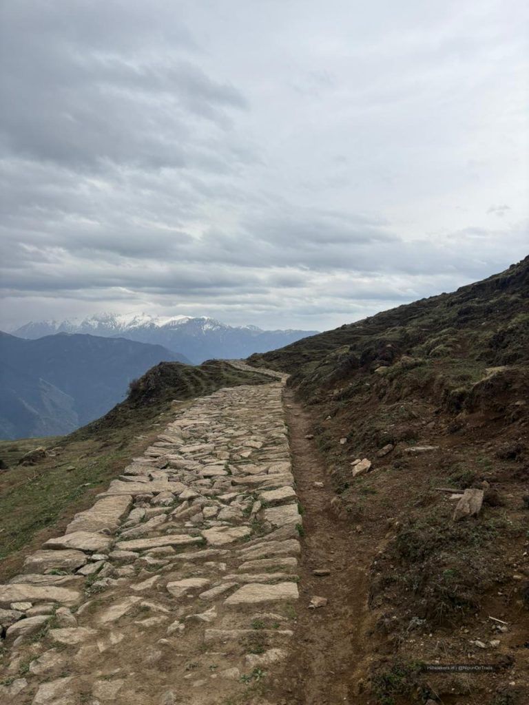
The trek can begin from either Raithal or Natin village. Both routes gradually climb through forests and eventually merge higher on the mountain. The trail passes through oak and rhododendron forests before reaching the meadows.
Gui and Chilpada are the most commonly used campsites on the route. Chilpada serves as a convenient base for exploring the upper meadows and nearby viewpoints. Barnala Tal, a small forest lake surrounded by trees, is located about 20–30 minutes from Chilpada campsite and is often visited along the way.
Beyond Chilpada, the landscape opens into the expansive meadows of Dayara Bugyal. The route offers continuous mountain views and allows trekkers to explore different sections of the bugyal before returning via the same route.
How to reach
Raithal / Natin
Reach Dehradun by train, bus or flight. From Dehradun, government and private buses as well as shared taxis operate towards Uttarkashi. From Uttarkashi, shared taxis are available to Bhatwadi, from where travellers can change to local shared vehicles for Raithal. Direct vehicles to Raithal may also be available depending on the season and time of day.
Map & Location
Base Village: Raithal / Natin
District: Uttarkashi
State: Uttarakhand
Nearest Railway Station: Dehradun
Nearest Airport: Dehradun
Region: Garhwal Himalayas
Safety
• Fit Beginners
• Regular Trekkers
• Moderate fitness recommended
• Cold nights during shoulder seasons
• Snow and ice during winter
• Sudden weather changes possible
• Limited shelter on the meadows
• Nearest Village : Osla
Gallery
FAQ
Didn’t find your question here? Contact us and we’ll be happy to help.