Harishchandragad
Quick Info
Altitude
1,424 m
Difficulty
Moderate
Distance
14 Km
Base Village
Pachnai • Khireshwar • Belpada • Lavhale
Duration
4 hrs
Best Season
Monsoon/Winter
Highlights
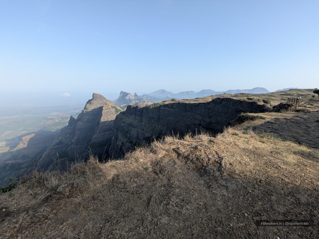
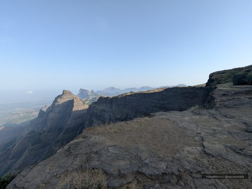
- Kokankada cliff
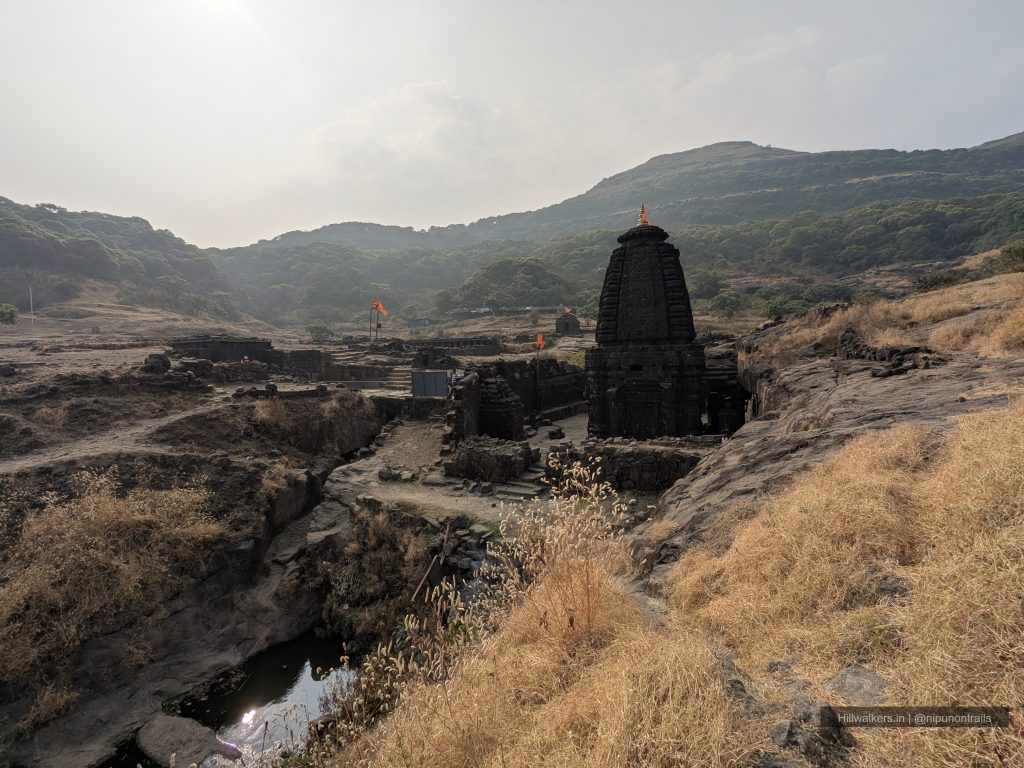
- Harishchandreshwar Temple
- Taramati Peak
- Camping Experience
- Sunrise & Sunset Views
- Ancient Fort Ruins
Overview
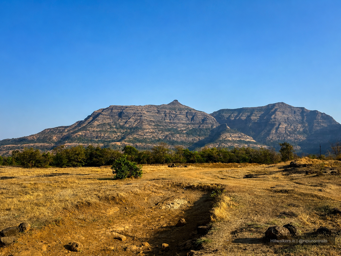
Harishchandragad is not just a trek. It is one of the oldest living forts in Maharashtra mentioned in ancient scriptures including the Matsyapurana and Skandapurana and standing at 1,424 metres above the Konkan plains, it demands respect before you even lace your boots.
The fort traces its origins to the 6th century CE, built during the Kalachuri dynasty. The cave temples on the plateau carved in the 11th century carry the marks of Shaiva, Shakta, and Naath traditions. The great sage Changdev, author of the Tatvasaar, is said to have meditated here in the 14th century. This is a place that has been home to devotion, warfare, and wilderness for over a thousand years. You feel that weight in the silence at the top.
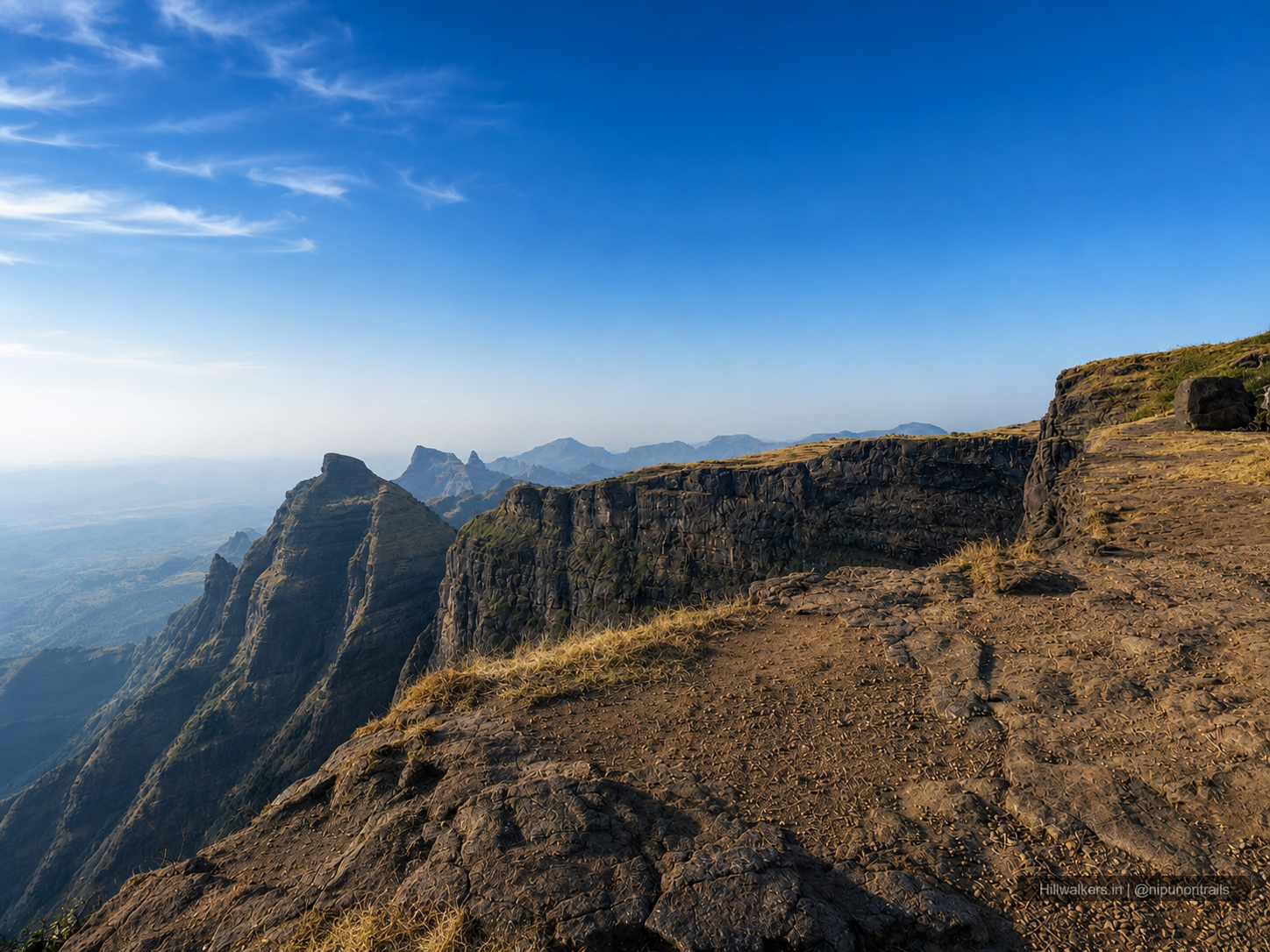
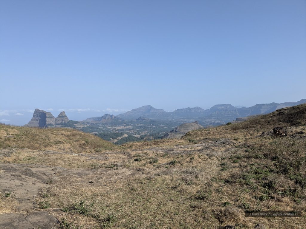
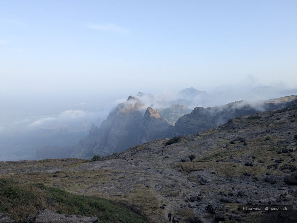
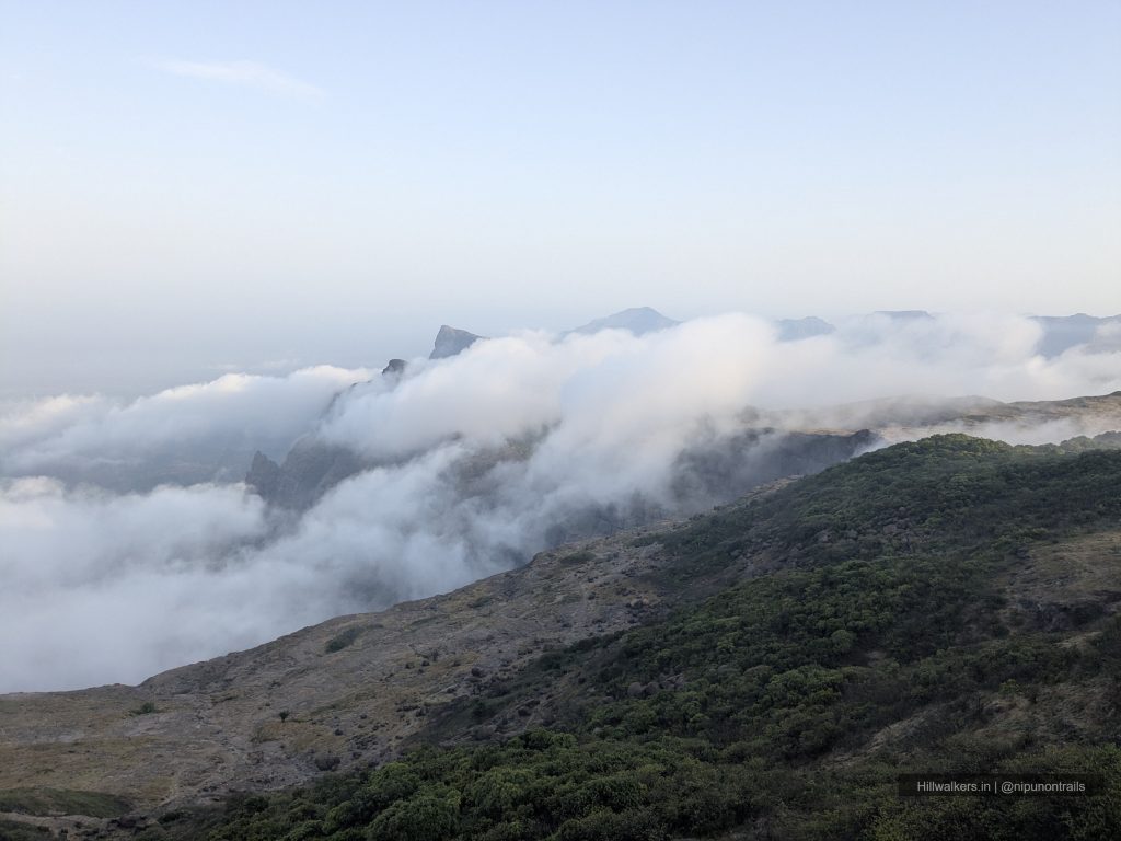
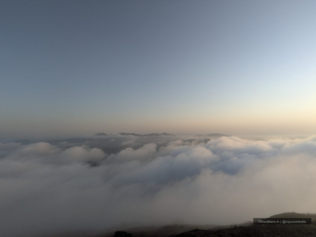
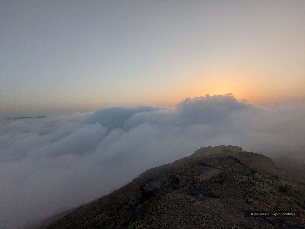
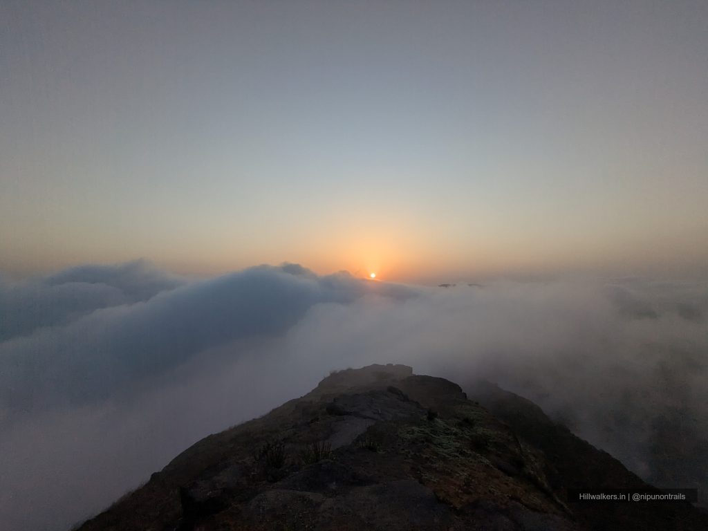
But what draws most trekkers here and what stops them in their tracks when they first see it is the Kokankada. A massive concave cliff shaped like a cobra’s hood, overhanging directly above the Konkan valley. On clear winter days, the drop below is infinite. On monsoon mornings, clouds rush upward through the gorge and throw themselves off the edge in what locals call a vertical cloudburst. At sunrise and sunset, the light does things you won’t find language for.
Harishchandragad is a complete trek in a way few others in the Sahyadri’s are history, altitude, a technical route option, camping on a plateau, a sacred cave temple, and one of the finest viewpoints in all of Maharashtra. All in two days.
Essentials
Water
Year round available
Network
Jio Partial coverage
Camping
Camping Allowed
Washroom
NA
Food
Available on pre-informed
Guide
Not Mandatory
What To Carry
Dry-fit T-shirt
Trek Pants
Windcheater / Rain Jacket
Extra Pair of Socks
Cap / Buff
Minimum 2L water
Energy Bar / Dry Snacks
Electrolytes
Headlamp / Torche
Powerbank
Trekking Pole
Backpack
Personal Medicines
Camera
Note: This checklist serves as a general guide. Adjust your gear based on weather, season, trek conditions, and personal requirements.
Routes
Pachnai Route
Base Village: Pachnai
Difficulty: Easy 🟢
Duration: 2 Hours
Distance: ~5 km
Pachnai is the shortest and easiest route to Harishchandragad. The trail gradually climbs through forests and open sections before reaching the plateau. It is ideal for beginners, families, and trekkers looking for a less demanding ascent.
Tolar Khind
Base Village: Khireshwar
Difficulty: Moderate 🟡
Duration: 3-4 Hours
Distance: ~7 km
The classic Harishchandragad route via Tolar Khind. It offers a mix of forest trails, rocky sections, and scenic viewpoints, making it one of the most popular approaches to the fort.
Junnar Darwaja
Base Village: Khireshwar
Difficulty: Moderate 🟡
Duration: 3-4 Hours
Distance: ~6 km
The Harishchandragad route via Junnar Darwaja also known as ‘Rajmarg’. It offers a mix of forest trails, rocky boulder sections, and scenic traverse along the needle hole.
Nalichi Vaat
Base Village: Valhivare
Difficulty: Difficult
Duration: 6+ Hours
Distance: ~6 km
Sadade Ghat – Bailghat
Base Village: Belpada / Valhivare
Difficulty: Moderate 🟡
Duration: 5-6 Hours
Distance: ~8 km
How to reach
Pachnai
Reach Rajur by bus or shared taxi and continue to Pachnai using local transport. Travellers from Mumbai can take a local train to Kasara and then continue towards Rajur. Frequent buses and shared jeeps operate between Kasara, Akole and Rajur during the day, making Pachnai one of the easiest base villages to reach using public transport.
Khireshwar
Travellers from Kalyan can board buses heading towards Aalephata or Ahilyanagar and get down at Khubi Phata. From there, local shared vehicles or lifts are usually available to reach Khireshwar village.
Valhivare / Belpada
Travellers from Kalyan can take buses towards Aalephata or Ahilyanagar and get down at Moroshi Phata. Local shared vehicles or lifts can be used to reach Valhivare. Bus services from Murbad to Valhivare are limited, so it is advisable to plan transport in advance.
Thitbi
Travellers from Kalyan can take buses towards Aalephata or Ahilyanagar and get down at Sawarne Phata. From there, local shared vehicles or lifts are usually required to reach Thitbi village.
One can book direct taxi from Kalyan / Kasara for the above villages.
Map & Location
Base Village: Pachnai
District: Ahilyanagar
State: Maharashtra
Nearest Railway Station: Kasara
Nearest Airport: Mumbai
Region: Western Ghats
Safety
Beginners
Families
Experienced Trekkers
Moderate fitness recommended
Slippery Sections during monsoon
Reduced visibility in fog
Nearest Village : Pachnai
Gallery
FAQ
Didn’t find your question here? Contact us and we’ll be happy to help.